Uganda
Wildlife and Action
English version see below.
Total Kilometer: 22`289 Kilometer
Totalzeit auf dem Rad: 1285 h
Land Kilometer: 914 Kilometer
Tage: 20 Tage
Erleichtert
Was bei der Grenze abläuft, habe ich noch nie erlebt. Ein bisschen mulmig ist mir schon und denke hoffentlich geht alles gut. Es hat tausende Leute auf der Strasse, zu Fuss, auf dem Velo oder hinter ihren Ständen wo sie jeden Kram verkaufen. Dazu Shuttle Busse und Mopeds, die hupend vorbei fahren. Manchmal fahre ich hinter einem Radfahrer-Taxi, nicht wegen dem Windschatten, sondern weil ich mich sicherer fühle von den entgegen kommenden Fussgängern und Mopeds. Der Grenzübergang verläuft einwandfrei. Geld wechseln. Ich bin in Uganda!
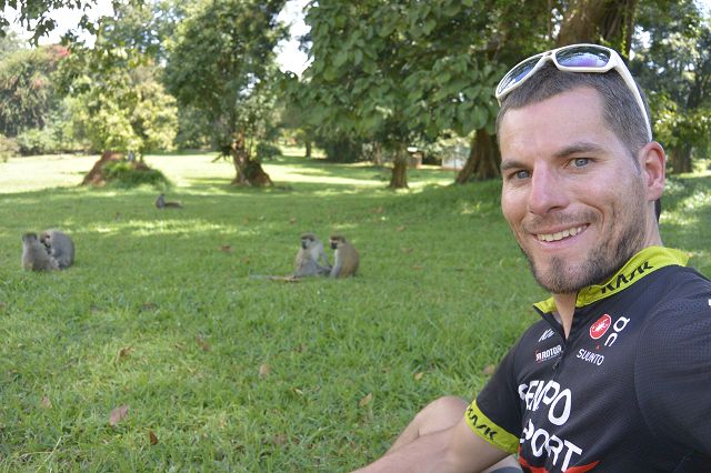
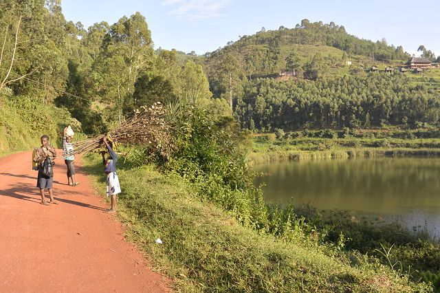
Nach der Grenze sah es genau gleich aus, schade. Dachte schon es wird besser… Moment! Die Stadt verlassend, wird die Strasse super glatt, immer mit einem tiefer liegenden Seitenstreifen. Es hat viele Radfahrer und Fussgänger, die ihn benützen. Die Landschaft ist sehr schön mit Hügeln, sehr dichten Wald, weitläufig. Fast kein Verkehr. Einbiegend auf die Hauptroute nehmen die Lastwagen zu, aber dank Seitenstreifen ganz ok. Plötzlich springen viele Affen über die Strasse, direkt auf Wassermelonen, die jemand fort geworfen hat. Auf einmal senkt sich die Landschaft auf eine weite Fläche. Die Häuser ändern sich schlagartig. Die Leute hausen meistens in runden Strohhütten.
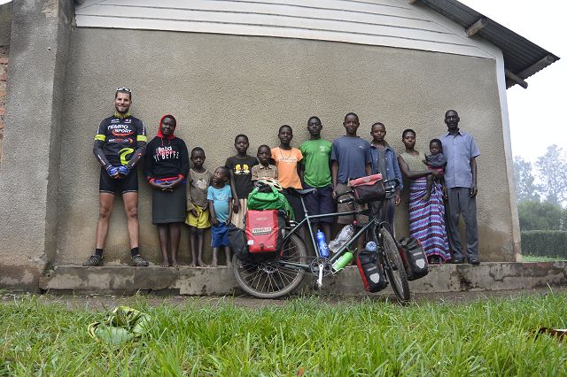
Man ist wie im vorletzten Jahrhundert versetzt. Am Horizont werden die Wolken dunkler. Ich zweige ab und bin auf einem coolen Pfad gelandet. Nur Radfahrer, Fussgänger und ein paar Mopeds. Mitten durch den Busch. Bei einem Weiler mit runden Strohütten stehe ich unter, als es runter kübelt. Später frage ich den Hausherr via Telefon, ob ich hier schlafen darf. Es stellt sich später heraus, dass es eine Pfarrei-Familie ist.
-

Kurz nach der Grenze kaufe ich ein Soda
-
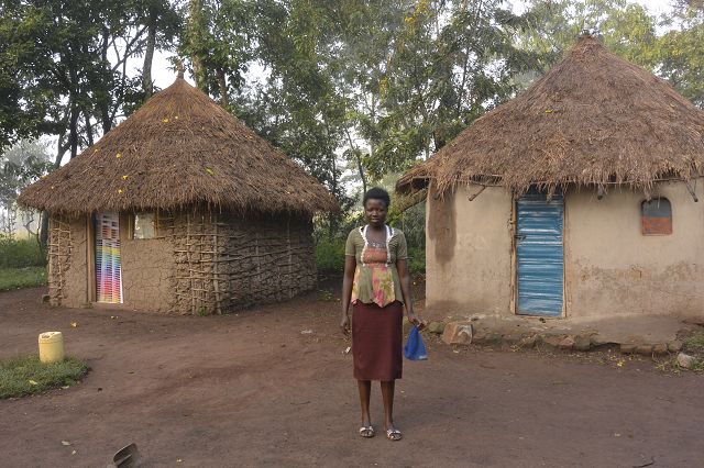
In runden Strohütten wohnen die Leute
-
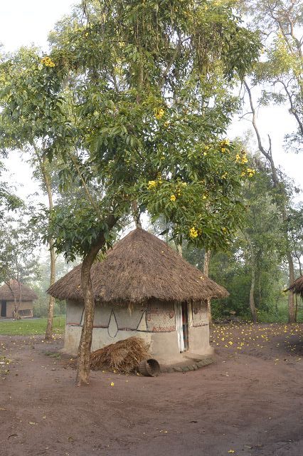
In runden Strohütten wohnen die Leute
-
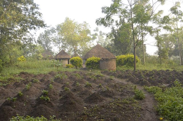
Jede Familie hat ihren eigenen Garten
-
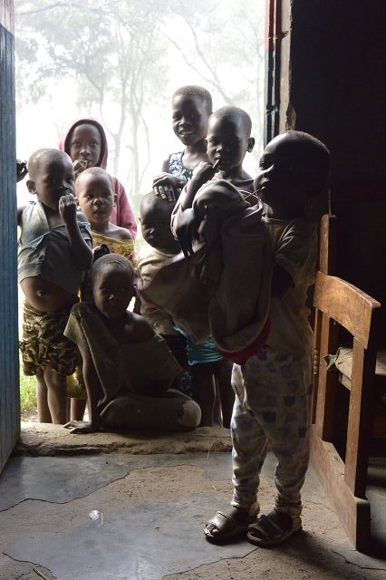
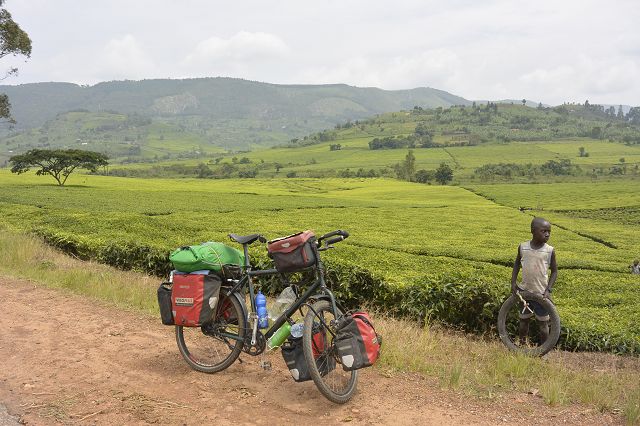
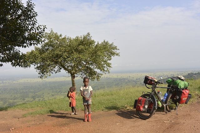
Die Kinder bestaunen den Muzungu
-

Die Pfarrei-Familie predigt mich zur Weiterfahrt
Nile of the Source
Früh morgens predigt mich der Vater berührend, damit ich eine gute, sichere Weiterfahrt habe. Der Pfad ist noch aufgeweicht vom starken Regen am Vortag. Vorbei gehts an runden Strohhütten, vor denen die Mütter Kleider waschen, Kinder spielen mit selbstgebastelten Abfall und die Männer sitzen meistens nur rum. Überall höre ich Jambo, Guten Tag, ein Lächeln im Gesicht oder ein herzliches Winken. Die Strasse wird breiter, aber immer noch unasphaltiert, es wird steiniger, heisser und mühsamer.
Bevor ich die Hauptstrasse nach Jinja nehme, esse ich zur Stärkung Chapati. Ein Mopedfahrer fährt in meinen Lenker. Gut hat er nur Stroh geladet, so ist es ein weicher Schlag.
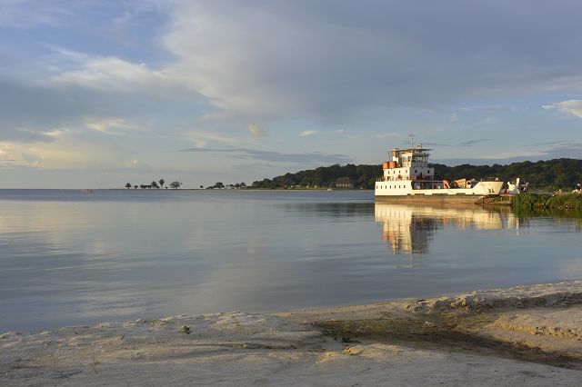
Jinja ist die viertgrösste Stadt Ugandas direkt am Viktoriasee wo der Nil entspringt. In der Nähe liegt der Owen-Falls-Damm, welcher für nahezu die gesamte Stromversorgung in Uganda und in Teilen Kenias verantwortlich ist. Im Explorers Backpacker niste ich mich ein. Die Entscheidung fälle ich im richtigen Moment im Mehrbettzimmer zu schlafen und nicht das Zelt auf zu stellen, denn zwei Minuten später dreht Petrus die Schleusen voll auf.
Irgendwie kommt man von hier nicht weg, bevor man ein River Rafting auf dem Nil vollbracht hat. Trotz des hohes Preises von 140$ buche ich dieses Highlight. Wir sind drei Boote, in jedem Boot sitzen sechs Touristen und hinten der Guide. Der Spass ist vorprammiert. Insgesamt hat es neun Stromschnellen auf fünfundzwanzig Kilometern.
Bitte siehe Video unter: http://www.kistler-around-the-world.ch/video/
-
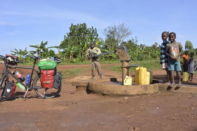
Pumpbrunnen gestiftet von South Korea
-
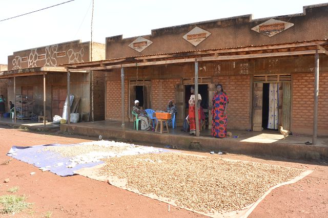
Die Saat trocknen sie meistens mitten auf der Strasse
-
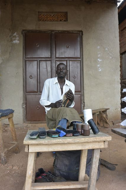
Schuhmacher
-
Imbisstand
-
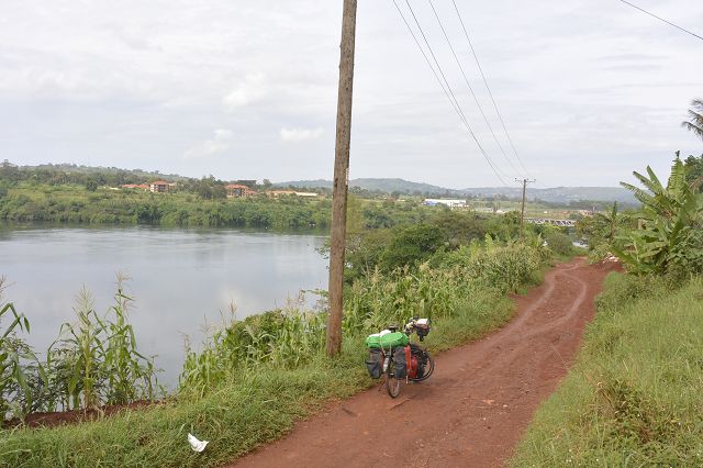
Fahrend entlang des Nile Ursprungs
-
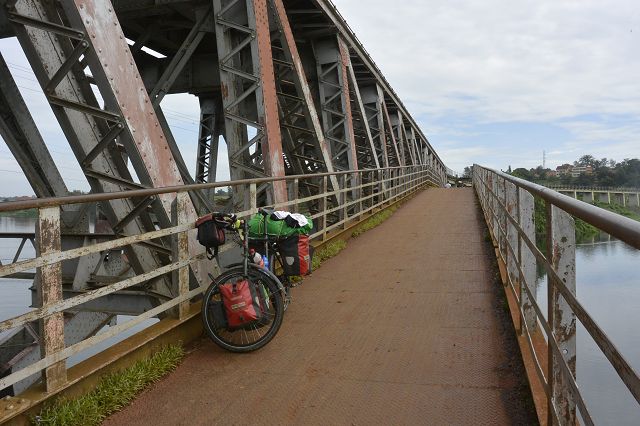
Alte Eisenbahnbrücke über den Nile
-
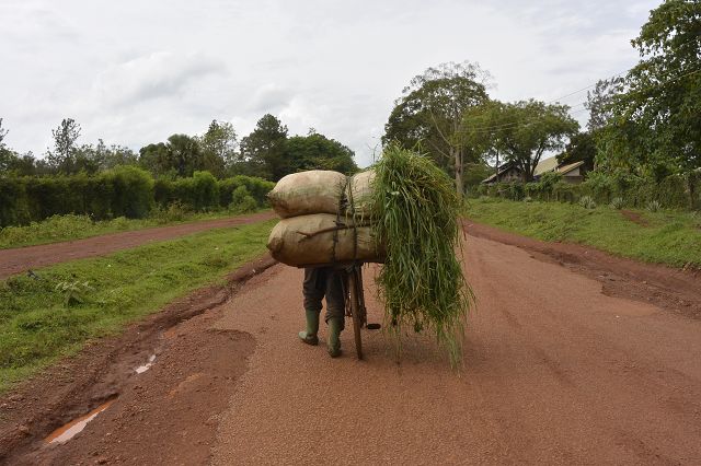
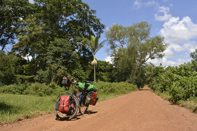
Schwer beladenes Fahrrad
-
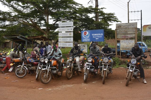
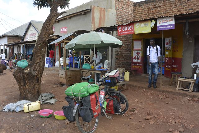
Mopedfahrer warten auf Kundschaft
-
Durch Farmfeldern
-
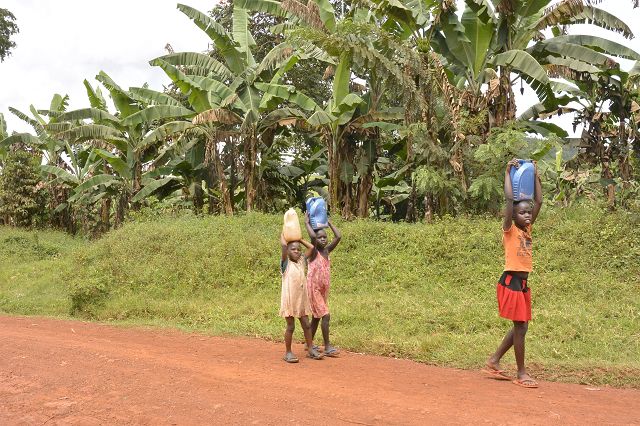
Anstatt in die Schule zu gehen, holen sie Wasser von weit weg
Bike Adventure Route
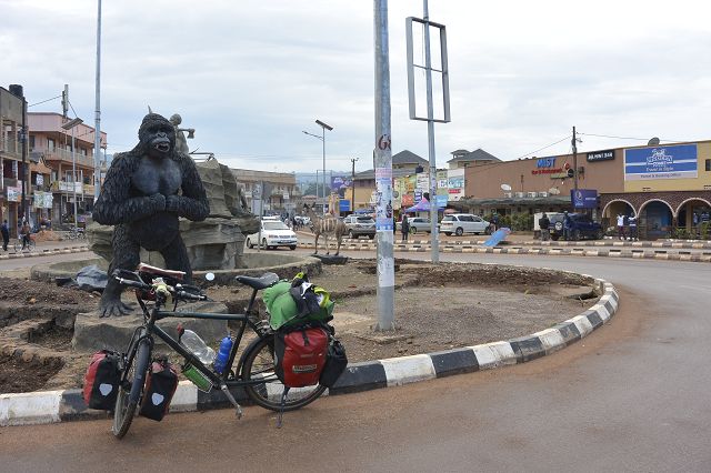
In Kampala logiere ich beim besten Warmshower Ugandas. Justus meint kühl, sein Haus ist auch mein Haus und ich darf solange bleiben wie ich möchte, trotz Abwesenheit seiner Person. Leider habe ich einen Zeitplan, den ich bis Kigali einhalten muss.
Auf der Website http://www.bike-adventure-tours.ch/ plane ich meine Route durch Uganda und Ruanda. Von der krassesten Stadt mit dem dichtesten Verkehr, den ich zuvor noch nie erlebt habe, kämpfe ich mich aus der Stadt raus nach Entebbe, wo die Bike-Adventure-Gruppe in wenigen Tagen landen. Von da an gehts mit einer Fähre zur Bugala Insel.
Eine traumhaft schöne Insel mitten im Viktoriasee. Es grenzen drei Länder, wie Tanzanien, Kenia und Uganda an den drittgrössten See der Welt, welcher gleichzeitig der zweitgrößte Süßwassersee der Welt ist. In Afrika ist er der grösste See, er verfügt über ein Einzugsgebiet von 193.000 km². Er hat eine Oberfläche von 68.800 km², dies entspricht in etwa der Fläche Bayerns oder Irlands.
Nach dem Verlassen des idyllischen Inseldörfchens führt es mich steil auf die Kammhöhe der Insel. Auf dieser folge ich bis zum anderen Ende. Vorbei an Bananen-, Mais- und Palmölplantagen und hie und da sichte ich Äffchen, die gekonnt in den Ästen herum turnen.
Wiederum mit einer Fähre gehts zurück auf das Festland. Zur Zeitgewinnung fahre ich auf der Hauptstrasse, die sehr hügelig ist, zum Mburosee National Park.
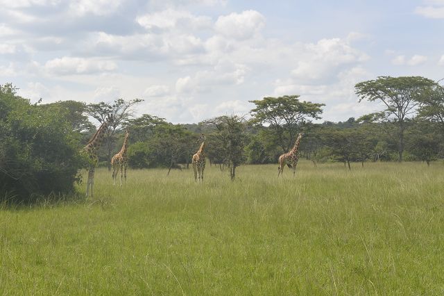
Ein unvergessliches Erlebnis erwartet mich heute! Vom Bike aus sehe ich Zebras, Impalas, verschiedene Affenarten, Büffel und Giraffen. Auf den Elan- oder Ruroko Tracks fahre ich auf verschlungene Wege durch Sumpfgebiete, akazienbewachsene Anhöhen bis zu Hügelkuppen mit herrlichem Panorama. Zwecks Orientierung und Sicherheit begleitet mich ein bewaffneter Ranger in militärischer Uniform. Am Schluss geniesse ich zwei kühle Coca-Cola am Mburosee mit Nilpferden.
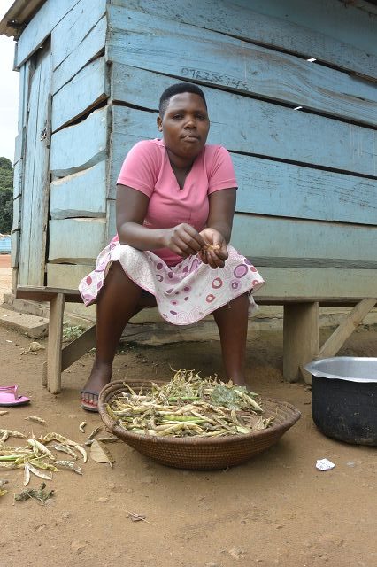
Den Lake-Mburo-Nationalpark und dessen feuchte Savannenlandschaft verlassend pedaliere nächsten Tages ich Richtung Mbarara, der drittgrössten Handelsstadt Ugandas. Kurze Zeit später biege ich ab auf eine Schotterpiste Richtung nächsten Nationalpark im Norden. Ich bin nie alleine unterwegs, ein geschäftiges Treiben beginnt bereits weit ausserhalb der Stadt. Bananentransporteure bringen ihre schwere Ernte auf lokalen Rädern zum Markt. Durch das Hinterland erlebe ich den authentischen Alltag der Bauern, die am Wegrand ihre Felder bestellen, Waren zum nächsten Markt bringen oder Hirten, die ihre Ankole-Rinder zur Wasserstelle treiben. Bei einer Pause komme ich in ein Gespräch und erlebe die ugandische Gastfreundschaft. Ich werde zu Banane (grüne) und Bohnen eingeladen. Der Ehemann, der mitisst, sagt für ein Ei oder eine Avocado ist leider nicht genügend Geld da. Er zeigt sein riesiger Garten mit seinen Bananenpalmen, Mais, Tomaten, Salate, Bohnepflanzen, Mango- und Zitronenbäume. In zwei Gehegen sitzen je viele Hasen und Ziegen. Traurig meint er, dass in wenigen Monaten die Regierung ein Teil seines Landes wegradiert, weil die neu erbaute Strasse genau auf seinem Land eine grössere Kurve macht.
-
Botanischer Garten in Entebbe
-
Meine Brüder
-
Fahrt über den Viktoriasee
-
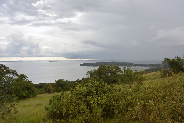
Insel Bugala im Viktoriasee
-
Fischerin prepariert ihre Ware für den Verkauf
-

Zebras im Mburo Nat. Park
-
Giraffen im Mburo Nat. Park
-
Mburosee
Queen Elizabeth Park
Der Nationalpark umfasst eine Fläche von rund 2000 km2 und liegt am unteren Ende des Rift Valley. Zu Beginn des 20. Jahrhunderts brach an dieser Stelle Epidemie artig die Schlafkrankheit aus. Zwischen 1925-1947 wurden das menschenverlassene Areal am Kazinga-Kanal zu Wildschutzgebieten erklärt, aus denen 1952 der Kazinga National Park hervorging. Zu Ehren der englischen Königin Elizabeth II. und anlässlich ihres Besuches im Jahr 1954 wurde der Park umbenannt. Die Landschaft reicht von offener Savanne, über Buschland, Sümpfe, Flüsse und Seen bis hin zu tropischen Feuchtwäldern. Im Norden des Parks grenzt das Ruwenzori-Gebirge an. Im Nordwesten liegt das Krater-Hochland mit seinen über dreissig, zum Teil mit Wasser gefüllten, Kratern. Schon in den 50er Jahren galt dieser Park als einer der eindrucksvollsten in ganz Afrika. Eine natürliche Wasserstrasse, der Kazinga-Kanal, verbindet den Lake Edward im Westen und den Lake George im Osten und teilt zugleich den Park in zwei Abschnitte. Die beiden Regionen sind durch sehr unterschiedliche Ökosysteme gekennzeichnet. Während der Krisenjahre in den 70er und 80ern litten die Tierpopulationen zwar stark, haben sich aber in den letzten 30 Jahren wieder sehr gut erholt. Im Gegensatz zu den anderen Parks befinden sich einige Dörfer innerhalb der Parkgrenzen.
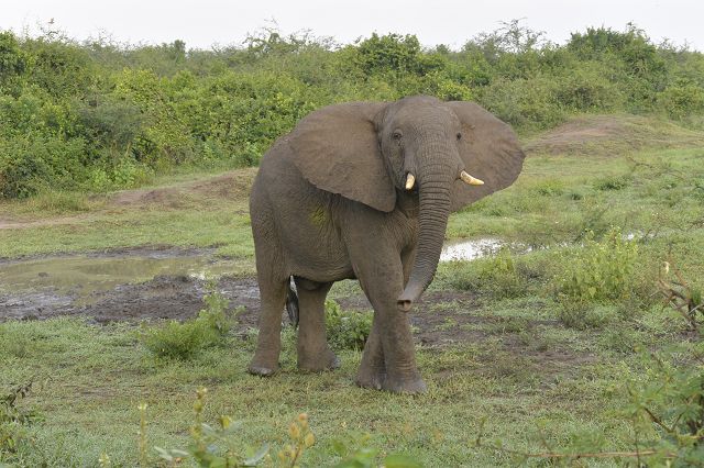
Frühmorgens geht es mit dem Fahrzeug auf Pirschfahrt in einen der artenreichsten Parks Afrikas. Viele Tiere darf ich beobachten, wie eine grosse Herde von Elefanten, Gazellen, Warzenschweine und Wasserböcke. Weit weg vom Pfad mögen einige Leute drei Löwen auf einem Baum sehen. Sogar per Feldstecher sehe ich nicht mal einen hellbrauen Punkt. Mein Fahrer riskiert es, den Pfad zu verlassen und ruft zu mir, ich solle die Kamera bereit halten. Es geht ganz schnell, wir erreichen den Baum. Er sagt: „Da, siehste?!“ Mit Gänsehaut erspähe ich eine Löwenmutter mit zwei super süssen Löwenjungen. Ergötzt sehen sie uns an und wir staunen. Ich drücke den Auslöseknopf der Kamera heiss. Bei der Rückfahrt sehen wir doch noch einen Ranger, der uns schon längst gesehen hat. Zum Glück gibt es keine Off-the-track-Busse. In einem Gebüsch vermuten einige zwei Löwenmännchen. Nach langer Warterei geben wir auf und fahren weiter.
Da, auf einmal sehen wir zwei schwarze Büscheln aus dem hohen Gras hin und her wackeln.
Mein Guide sagt freudig: „Das sind die Löwen!“ Kaum zu glauben, sie schlagen den direkten Weg zu uns ein und spazieren kurze Zeit später gemütlich an uns vorbei. Das beste Tier-Highlight meiner bisherigen Afrika Reise.
Mein Zelt schlage ich in einem gemütlichen Resort mit WiFi auf. Die Tierwelt kann einem zu tode erschrecken. Am Abend kommen immer die gleichen zwei bis drei Elefanten vor das Resort und fressen Blätter von den Bäumen. Ich gehe so nahe dran, wie ich darf. Doch anscheinend mag der Elefant mein weisses T-Shirt nicht und sprintet mit hoher Geschwindigkeit in meine Richtung. Ich nehme meine Beine unter die Arme und sprinte so schnell ich kann zwischen Häuser und Bäumen davon. Der Dickhäuter kommt da nicht durch, hab ich Glück!
In der Nacht renne ich zu meinem Zelt, um es schliessen zu wollen, weil es Sintflutartig anfängt zu regnen. Entlang des Weges säumt eine hüfthohe Hecke. Im Schein meiner Stirnlampe sehe ich plötzlich ein Nilpferd. Da ich weiss, dass diese Kolosse die gefährlichsten Tiere von Afrika sind, bekomme ich einen unglaublichen Schrecken und sprinte zurück zur Reception und rufe: „Hilfe, ein Nilpferd!“ Sie fragen mich, ob es mich angegriffen hat. Ich verneine. Da lachen sie nur und meinen: „Die sind so niedlich wie ein Schosshündchen, nur wenn man in ihre Quere kommt, schnappen sie zu!“
Kazinga Kanal
Am Nachmittag unternehme ich eine Bootsfahrt auf dem Kazinga Kanal. Der 36 km lange Kazinga-Kanal verbindet den Lake George mit dem Lake Edward. Über 550 Vogelarten, Flusspferde, Büffel, Nilwarane und Krokodile kann ich aus sicherer Entferung bestaunen. Mittendrin hat sich ein Fischerdorf mit der Natur arrangiert und lebt nach überliefertem Wissen mit dieser Tierwelt zusammen.
-
Durch malerische Hügellandschaften
-
Teeplantagen
-
Überblick über den Queen National Park
-
Nichts wie weg von hier!
-
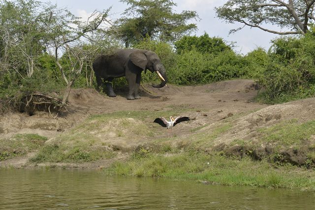
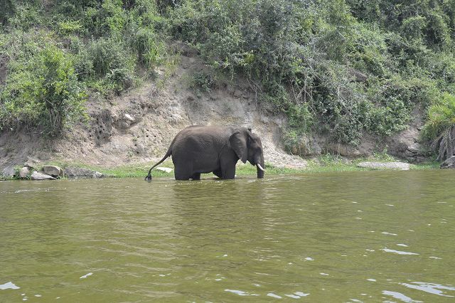
Elefant und Vogel
-
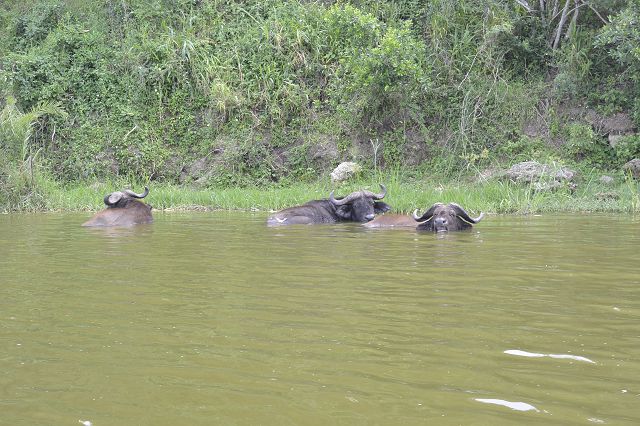
Wasserbüffeln
-
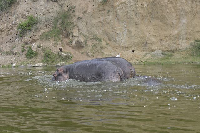
Nilpferde
-

Löwenmännchen
-
Wo sind die Löwen?
-
Elefant nimmt ein Wasserbad
Bwindi Nationalpark
Der 331 km2 grosse Bwindi Impenetrable Nationalpark in Südwestuganda, am Rand des Zentralafrikanischen Grabens gehört seit 1994 zum UNESCO-Welterbe. Dieser geschützte Lebensraum ist Heimat für eine grosse Population von Berggorillas, die mit ca. 340 Tieren fast die Hälfte der Weltpopulation ausmachen. Daneben leben auch Schimpansen, andere Affen-Arten, Elefanten und verschiedene Klein-Antilopen in diesem Schutzwald. Die Vegetation im Nationalpark besteht aus dichten Berg- und Regenwäldern mit undurchdringlichem Unterwuchs. In dem von zahlreichen Bachläufen gegliederte Wald liegen mehrere Sumpfgebiete. Das Mubwindi Swamp im Südosten des Parks bei Ruhija ist mit 2 km2 das grösste Sumpfgebiet.
Vom Queen Elizabeth Park schlängle ich mich durch die Hügellandschaft vom Westen Ugandas. Vorbei an grossen Teeplantagen und wunderschöner Hügellandschaft. In einem Dorf treffe ich auf die Berggorills-Safari Gruppe und schliesse mich denen an.
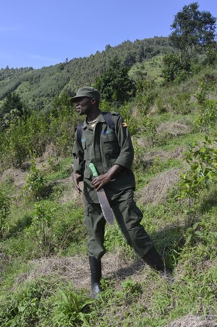
Die Chance stehen gut eine Familie der Berggorillas zu erblicken. Die letzten ihrer Art, man schätzt ca. 700 Berggorillas, sind in den Ausläufern von Ur- und Regenwäldern der Virunga Berge und Bwindi Nationalpark zu finden, dem Bergmassiv, welches zwischen Ruanda, Uganda und Kongo verläuft. Frühmorgens beim Park Office erledigen wir die Formalitäten für das Gorilla-Tracking. Pro Gorillagruppe ist die
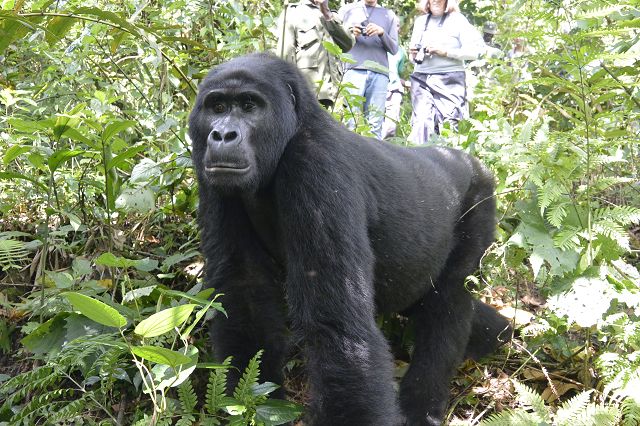
Teilnehmerzahl pro Tag beschränkt. Die Startpunkte sind je nach zugewiesener Berggorillagruppe unterschiedlich. Zu Fuss starten wir in einer riesigen Gruppe, in Begleitung von Rangern. Weitere Ranger sind als Späher vor uns gestartet und übermitteln uns den genauen Standpunkt der Gruppe. Als wir sie erreicht haben, verbringen wir genau eine Stunde in nächster Nähe zu den Tieren. Wir beobachten, wie diese einzigartigen Tiere in einem Familienverbund von bis zu 20 Mitgliedern durch die Wälder streifen. Die Gruppe wird von dem bis zu zwei Meter grossen und bis zu zweihundert Kilogramm schweren „Silberrücken“ angeführt. In unserer Gruppe befinden sich zwei von diesen Giganten.
Wir erleben die Verhaltens- und Kommunikationsweisen der Tiere untereinander, die fast schon menschlichen Verhaltensweisen gleichen.
-
Ranger und Spotter
-
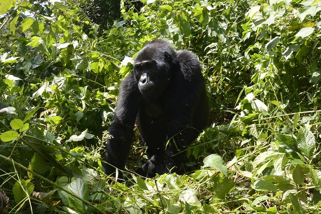
Berggorilla
-

Berggorilla
-
Berggorilla
-

Berggorilla
-
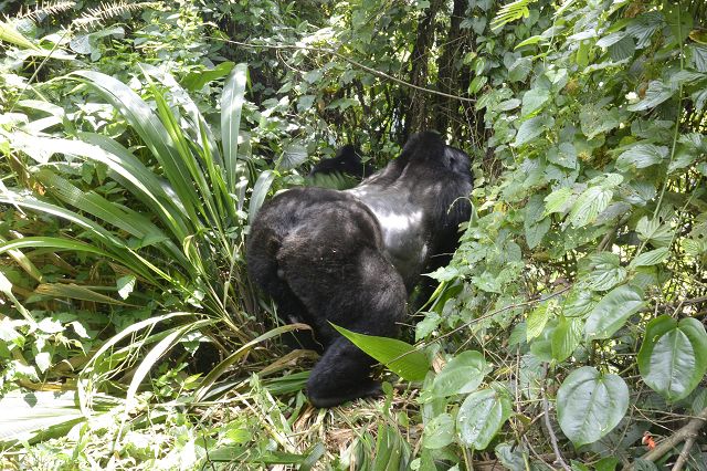
Berggorilla, Silberrücken
-
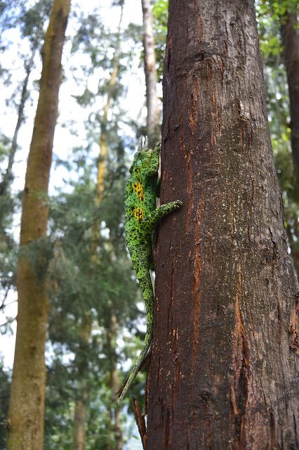
Chamäleon
-
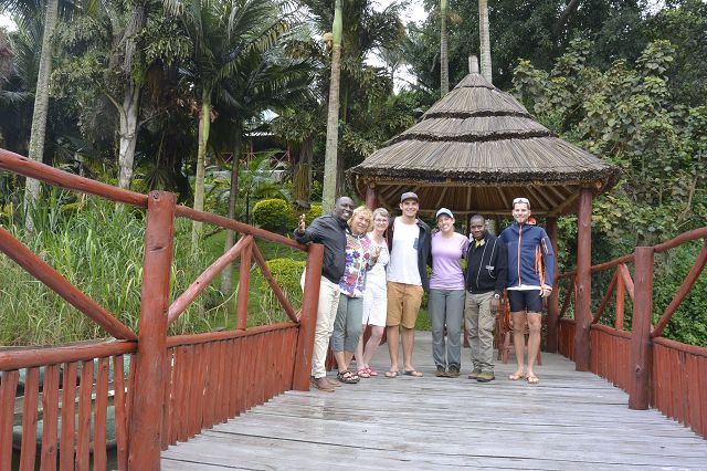
Berggorilla-Safari-Gruppe
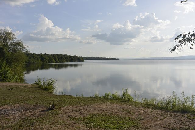
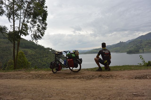
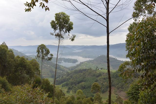
Lake Bunyonyi
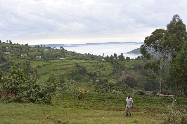
Wieder tauche ich in die bepflanzte Hügellandschaft ein. Jedes Flecklein des so fruchtbaren Bodens wird genutzt. Auf einer Teerstrasse erreiche ich Kabale. Ein kleiner Pass führt mich zum Lake Bunyonyi. Von der Passhöhe geniesse ich einen fantastischen Blick über den See.
Der schöne Bunyonyi-See liegt sieben Kilometer von der Stadt Kabale entfernt, im Südwesten Ugandas. Er ist 25 km lang, 7 km breit und bedeckt eine Fläche von 6100 Hektaren. Er ist mit 920 m Tiefe der zweittiefste See Afrikas. Der See liegt auf 1950 m und ist von kultivierten Hügeln umgeben, die von 2200-2478 Meter reichen.
In einem Resort darf ich mein Zelt für nur 5$ aufstellen, ein traumhaftes Plätzchen, doch leider zwingt mich mein Zeitplan weiter zu radeln. Am Abend lerne ich die Kathrin von Tschechien kennen. Wir geniessen einen Drink und würden nie erahnen was uns die Zukunft bringt… (siehe Tansanischer Bericht).
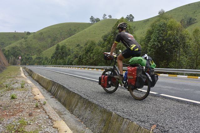
Entlang des See auf holprigster Strasse führt es mich an vielen Farmfeldern vorbei. Der Blick runter zum See hält mich immer wieder an, um die Aussicht zu geniessen. Viele Leute sind zu Fuss oder mit dem Fahrrad unterwegs, denn Geld für ein Auto haben sie nicht. Auch von Lastwagen, Minibussen oder stinkigen Mopeds werde ich verschont.
Zurück auf der gut neu ausgebauten Hauptstrasse treffe ich auf eine nach dem Tod ringenden Schlange. Der Mörder sagt kühl: „Es war eine giftige Schlange.“
Üeber zwei schöne Pässe führt es mich durch einen Regenwald. Nach einer Kurve kommt mir plötzlich eine Baboon Familie entgegen. Mit Respekt halte ich genügend Abstand, ihre grossen Zähne sehe ich schon in meinen Fahrrad-Waden.
Der Ausblick vom letzten Pass über das Land ist überwältigend. Am Horizont sehe ich viele Vulkane, die teils in Uganda, Ruanda und im Kongo stehen. Manche sind höher als viertausend Metern. Die Grenze zu Ruanda kann ich gut erahnen.
Sehnsuchtsvolle Grüsse
Stephan
-
Kabale
-
Bunyonyi-See
-

Bunyonyi-See
-
Bunyonyi-See
-
Bunyonyi-See
-
Bunyonyi-See
-
Gastfreundschaft vom Feinsten
-
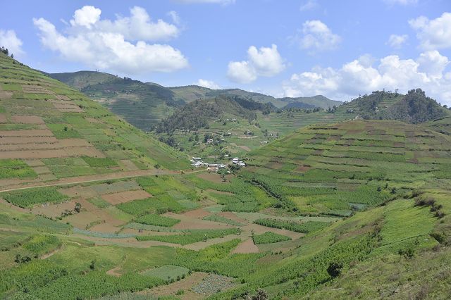
Jeder Quadratmeter wird ausgenutzt
English Version:
Facilitated
Was at the border expires, I have never experienced. A bit queasy is nice to me and I think everything is fine. It has thousands of people on the street, on foot, on the bike or behind their stalls selling stuff. These shuttles and mopeds, the honking drive past. It can be said that I drive a bicyclist taxi, and I think I can handle the contrasts and the mopeds better. The border crossing runs smoothly. Change money. I am in Uganda!
After the border it looked exactly, too bad. Thought it is getting better … wait! Leaving the city, the road becomes super smooth, always with a deeper siding. It has many cyclists and pedestrians who use each other. The landscape is very beautiful with hills, very dense forest, spacious. Almost no traffic. Including on the main route to take the trucks, but wet side stripes ok. Suddenly, many monkeys jump across the street, right on watermelons, which has thrown away jeand away. Suddenly the landscape thinks of a wide area. The houses change abruptly. People got married in straw hats.
One is as in the penultimate century offset. On the horizon, the clouds are dark. I turn off and land on a cool path. Only cyclists, pedestrians and a few mopeds. In the middle of the bush. At a hamlet of thatched huts, I sting as it sinks down. I ask the landlord via phone, if I may sleep here. It turns out a little later that it is a parish family.
Nile of the Source
Early in the morning the father preaches to me touchingly, so that I have a good, safe onward journey. The path is still softened by the heavy rain the day before. Gone are round straw huts where mothers wash clothes, children play with home-made garbage and most of the time the men just sit around. Everywhere I hear Jambo, hello, a smile on my face or a warm wave. The road becomes wider, but still unpaved, it gets stony, hotter and laborious.
Before I take the main road to Jinja, I eat to strengthen Chapati. A moped driver drives into my handlebars. Well, he just loaded straw, so it’s a soft punch.
Jinja is the fourth largest city in Uganda, right on Lake Victoria, where the Nile springs. Nearby is the Owen Falls Dam, which is responsible for nearly all of the power supply in Uganda and parts of Kenya. I nest in Explorers Backpacker. The decision to fall asleep in the dormitory at the right moment and not to put up the tent, because two minutes later, Peter opens the floodgates.
Somehow you can not get away from here before you have done a river rafting on the Nile. Despite the high price of $ 140, I book this highlight. We are three boats, in each boat there are six tourists and behind the guide. The fun is pre-tested. In total, it has nine rapids at twenty-five kilometers.
Please see video at: http://www.kistler-around-the-world.ch/video/
Bike Adventure Route
In Kampala I’m staying at Uganda’s best warmshower. Justus means cold, his house is also my house and I can stay as long as I want, despite the absence of his person. Unfortunately, I have a schedule that I have to adhere to Kigali.
I plan my route through Uganda and Rwanda on the website http://www.bike-adventure-tours.ch/. From the most blatant city with the heaviest traffic I’ve ever encountered, I fight my way out of town to Entebbe, where the bike adventure group lands in a few days. From there on a ferry to Bugala Island.
A beautiful island in the middle of Lake Victoria. Three countries, such as Tanzania, Kenya and Uganda border the third largest lake in the world, which is also the second largest freshwater lake in the world. In Africa it is the largest lake, it has a catchment area of 193,000 km ². It has a surface of 68,800 km², which roughly corresponds to the area of Bavaria or Ireland.
After leaving the idyllic island village, it leads me steeply to the ridge of the island. On this I follow to the other end. Past banana, corn and palm oil plantations and every now and then I see monkeys skilfully doing gymnastics in the branches.
Again with a ferry back to the mainland. For time I drive on the main road, which is very hilly, to Mburosee National Park.
An unforgettable experience awaits me today! From the bike I can see zebras, impala, various monkeys, buffalo and giraffes. On the Elan or Ruroko tracks I drive on winding paths through wetlands, acacia-covered hills to hilltops with stunning views. For guidance and safety, an armed ranger in military uniform accompanies me. In the end, I enjoy two cool Coca-Cola on Mburosee with hippos.
Leaving the Lake Mburo National Park and its wet savannah landscape, I pedal next day towards Mbarara, the third largest commercial city in Uganda. A short time later I turn off on a gravel road towards the nearest national park in the north. I’m never alone, a busy life starts far away from the city. Banana transporters bring their heavy harvest on local wheels to the market. Through the hinterland, I experience the authentic everyday life of the farmers who order their fields along the wayside, bring goods to the next market or shepherds who drive their Ankole cattle to the waterhole. At a break, I come in a conversation and experience the Ugandan hospitality. I am invited to banana (green) and beans. The husband, who says yes, says there is not enough money for an egg or an avocado. He shows his huge garden with its banana palms, corn, tomatoes, salads, bean plants, mango and lemon trees. There are many rabbits and goats in two enclosures. Sadly he thinks that in a few months the government will eradicate a part of his country, because the newly built road makes a bigger bend on his own country.
Queen Elizabeth Park
The national park covers an area of approximately 2000 km2 and lies at the lower end of the Rift Valley. At the beginning of the 20th century epidemic broke out at this point epidemic like sleeping sickness. Between 1925-1947, the deserted area on Kazinga channel were declared a wildlife sanctuary, from which 1952, the Kazinga National Park emerged. In honor of the English Queen Elizabeth II and on the occasion of her visit in 1954, the park was renamed. The landscape ranges from open savannah, over scrubland, swamps, rivers and lakes to tropical humid forests. In the north of the park is adjacent to the Ruwenzori Mountains. In the northwest lies the crater highlands with its more than thirty, partly filled with water, craters. As early as the 1950s, this park was considered one of the most impressive in Africa. A natural waterway, the Kazinga Channel, connects Lake Edward to the west and Lake George to the east while splitting the park into two sections. The two regions are characterized by very different ecosystems. During the crisis years of the 1970s and 1980s, animal populations suffered greatly, but have recovered very well in the last 30 years. Unlike the other parks, some villages are within the park boundaries.
Early in the morning we drive with the vehicle on a game drive in one of the most species-rich parks in Africa. I can observe many animals, like a big herd of elephants, gazelles, warthogs and waterbuck. Far away from the path some people like to see three lions on a tree. Even by field glasses I do not even see a light brown point. My driver risks leaving the path and calls me to keep the camera ready. It goes very fast, we reach the tree. He says: „There, you see ?!“ With goose bumps I spy a lion mother with two super cute lion cubs. Delighted they look at us and we are amazed. I press the trigger button of the camera hot. On the way back we still see a ranger who has seen us long ago. Luckily, there are no off-the-track buses. In a bush some two lion-men suspect. After a long wait, we give up and drive on.
There, at once we see two black clumps waggling from the tall grass.
My guide says joyfully: „These are the lions!“ Hard to believe, they hit the direct route to us and walk a short time later comfortably past us. The best animal highlight of my recent trip to Africa.
I pitch my tent in a cozy resort with WiFi. The wildlife can scare one to death. In the evening, the same two or three elephants come in front of the resort and eat leaves from the trees. I’m going as close as I can. But apparently the elephant does not like my white T-shirt and sprints in my direction at high speed. I take my legs under my arms and sprint as fast as I can between houses and trees. The pachyderm can not get through, I’m lucky!
At night, I run to my tent to close it because it starts to rain with torrents. Along the way, a waist-high hedge lines. In the light of my headlamp, I suddenly see a hippopotamus. Knowing that these colossi are the most dangerous animals in Africa, I get an incredible shock and sprint back to the front desk shouting, „Help, a hippopotamus!“ They ask me if it attacked me. I refuse. They just laugh and say, „They are as cute as a lap dog, only when they get in their way do they snap!“
Kazinga channel
In the afternoon I take a boat trip on the Kazinga Channel. The 36 km Kazinga Canal connects Lake George with Lake Edward. Over 550 species of birds, hippos, buffaloes, Nile monitors and crocodiles, I can marvel at safe distance. In the middle of it, a fishing village has come to terms with nature and, according to traditional knowledge, lives together with this animal world.
Bwindi National Park
The 331 km2 Bwindi Impenetrable National Park in Southwest Uganda, on the edge of the Central African Rift Valley, has been a UNESCO World Heritage Site since 1994. This protected habitat is home to a large population of mountain gorillas, which make up about half of the world’s population of about 340 animals. In addition, live chimpanzees, other monkey species, elephants and various small antelope in this protective forest. The vegetation in the National Park consists of dense mountain and rainforests with impenetrable vegetation. In the forest, which is divided by numerous streams, there are several wetlands. The Mubwindi Swamp in the southeast of the park near Ruhija is with 2 km2 the largest swamp area.
From Queen Elizabeth Park I meander through the hilly landscape of western Uganda. Past big tea plantations and beautiful hilly landscape. In a village, I meet the mountain gorilla safari group and join them.
The chance to see a family of mountain gorillas is good. The last of its kind, estimated at about 700 mountain gorillas, can be found in the foothills of primeval and rainforests of the Virunga Mountains and Bwindi National Park, the mountain range that runs between Rwanda, Uganda and Congo. Early in the morning at the Park Office we do the formalities for gorilla tracking. Per Gorilla group is the
Limited number of participants per day. Starting points vary depending on the assigned mountain gorilla group. On foot we start in a huge group, accompanied by Rangers. Other rangers have started as scouts before us and give us the exact point of view of the group. When we reach them, we spend exactly one hour in close proximity to the animals. We observe how these unique animals roam through the forests in a family of up to 20 members. The group is led by the up to two meters large and up to two hundred kilograms heavy „Silverback“. In our group are two of these giants.
We experience the behaviors and modes of communication of the animals among themselves, which almost resemble human behaviors.
Lake Bunyonyi
Again I dive into the planted hills. Every patch of the soil that is so fertile is used. I reach Kabale on a tarred road. A small pass leads me to Lake Bunyonyi. From the top of the pass I enjoy a fantastic view over the lake.
The beautiful Bunyonyi Lake is located seven kilometers from the city of Kabale, in southwest Uganda. It is 25 km long, 7 km wide and covers an area of 6100 hectares. At 920 m, it is the second deepest lake in Africa. The lake is located at 1950 m and is surrounded by cultivated hills ranging from 2200 to 2478 meters.
In a resort, I’m allowed to set up my tent for only $ 5, a fantastic spot, but unfortunately, my schedule is forcing me to continue cycling. In the evening I meet Kathrin from the Czech Republic. We enjoy a drink and would never guess what will bring us the future … (see Tanzanian report).
Along the lake on bumpiest road it leads me past many farm fields. The view down to the lake keeps me from time to time to enjoy the view. Many people are on foot or by bicycle, because they have no money for a car. Even trucks, minibuses or stinky mopeds I will be spared.
Back on the well-rebuilt main road, I encounter a serpent wrestling after death. The killer says coolly, „It was a venomous snake.“
Over two beautiful passes it leads me through a rainforest. After a bend suddenly comes to meet a Baboon family. With respect I keep enough distance, I already see her big teeth in my bicycle calves.
The view from the last pass over the country is overwhelming. On the horizon I can see many volcanoes, some of them in Uganda, Rwanda and the Congo. Some are higher than four thousand meters. I can well guess the border with Rwanda.
Sincere greetings
Stephan